If you have ever visited Quetzaltenango, or Xela for short, you will know that there are some amazing hikes around the area.
Volcano Tajumulco, sitting at 4202 meters above sea level, is the highest peak in Central America.
Volcano Chicabal, sitting at 2720 meters above sea level, contains a sacred crater lake at the top of the volcano.
However, you might notice that a lot of these hikes will suggest that you go with a tour guide. Well if you are like us and like spending that extra money on food instead, you might have considered going on a hike without a guide.
Here you will find out how to hike the impressive volcano Santa Maria SAFELY without a tour guide, how to not get lost, what to bring with you on your hike, how difficult is the hike, and more importantly, whether is it dangerous to hike Volcano Santa Maria without a guide?
Where To Take The Bus from Xela to Volcano Santa Maria Hiking Trail
The hike up to the top of volcano Santa Maria begins at a town called Llano de Pinal. For that reason, you will need to catch a chicken bus or “camionetta” from Xela to Llano de Pinal. Locals refer to the place just as Pinal so make sure you don’t get confused.
Before you catch the bus, you will need to download an app called maps.me to lead the way and ensure you don’t get lost. Download the app and then download the offline maps for Guatemala which will include the hiking path to the top of Volcano Santa Maria.
The buses start running at 6 AM and I highly recommend catching the first bus to Pinal. The hike itself takes about 6 hours round-trip and round-trip transportation takes about 2 hours. Also, “Guatemalan time” is a thing, a bus that is supposed to arrive at 6 AM can arrive at 6:30 AM or later. You do not want to be stuck at Llano de Pinal.
To catch the bus you go to have to Iglesia El Calvario near Parque El Calvario. Be careful because there are two Iglesia El Calvario. You want to go to the one near Parque El Calvario.
Here is a Google Maps image of where it should be.

The highlighted spot is where you will take the bus from Xela to Llano de Pinal. Be careful don’t just get on any bus because many buses and small vans will pass by the area.
Also, take the bus that’s going in the right direction!!! When you get on a bus that says Llano de Pinal or just Pinal in the front, ask the bus driver if it going to Pinal by just saying “Pinal?”
If you refer to the map below, the bus should be going from right to left, away from the main city of Xela.
Again, 6 AM. Be there or be in bed I guess.
How to Not Get Lost On Your Volcano Santa Maria Hike
So you took the bus to Llano de Pinal and got off at the end or kicked off by the bus conductor. What do you do now?
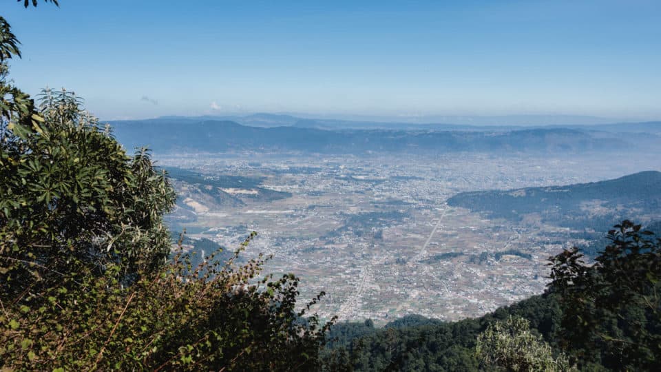
When you get off the bus, you should be able to see Volcano Santa Maria in the distance. Just follow the main path towards the volcano and you will arrive at the bottom of Volcano Santa Maria shortly.
If you get off the bus and the weather is extremely cloudy and foggy and you cannot see Volcano Santa Maria from the distance, simply follow the main road in the direction the bus was going (away from Xela).
It can get really foggy sometimes.

If you are still confused, use the application maps.me on your phone and it will indicate where to go. (It can be used without an internet connection!!)
The beginning of the hike will be local farms and such. Don’t be surprised if you see locals with donkeys and horses around this part of the hike.

We actually saw a man with a machete walking down and I was immediately terrified. In my head, I thought I was going to get robbed and there was no way of escaping. Turns out, it was a local farmer who was using a machete to help him with his work. So if you see the same thing, don’t freak out!
The path is relatively straightforward and difficult to get lost. If you ever have doubts you can either ask a local (there will be tons) or refer to maps.me. Maps.me is literally a lifesaver.
You should arrive at the top of Volcano Santa Maria within 4 hours. The descending is much easier and takes about 2-3 hours.
Volcano Santa Maria Hike Packing List
If you are hiking during the rainy season (May through October), you might want to consider packing a raincoat or a rain poncho
I highly recommend the Arcturus Reusable Rain Poncho.
Besides the rain poncho, you should be bringing around 2L of water for your hike, snacks, and a packed lunch. Nuts and fruits are great choices for a snack.
Sunscreen is highly recommended because you will be at a high altitude for long periods of time. Insect repellent is not necessary.
Bring a light jacket, something like a windbreaker or sweater for the cold early mornings. However, as you start hiking, the weather will warm up so quickly that a t-shirt and shorts can suffice in the end.
Is Hiking Volcano Santa Maria Dangerous?
Even though Guatemala gets a bad reputation for being a fairly dangerous country, the hike to volcano Santa Maria is fairly safe.
In my one-month stay in Xela, I did not hear anyone get robbed on the way up to Santa Maria.
When you hike up, chances are there will be a lot of locals that are either hiking as well or farming around the area. The locals have ceremonies at the top of the volcano.
If you are still afraid, you can even request a police escort up the mountain at the police station.
Your biggest worry should be not getting lost instead. So I would say if you are pretty good with directions and know how to use maps.me well, this hike is NOT dangerous for you.
We recommend purchasing reliable travel insurance before visiting Guatemala.
Santa Maria Volcano Hike Difficulty

Hiking volcano Santa Maria is definitely not the easiest feat. At the peak of volcano Santa Maria, you are at 3772m above sea level. That means symptoms of altitude sickness might appear, including headaches, nausea, and much more.
In addition to the high altitude, the path is not difficult but very consistently steep. It is not a technical hike, you don’t have to jump over rocks or climb them whatsoever. But it is hours of consistent hard hiking. If you have hiked volcano Acatenango in Antigua and watched volcano Fuego erupt, this hike is relatively easy compared to that.
The difficulty is somewhere between hiking volcano Pacaya in Antigua and volcano Acatenango, if you have hiked those already.
When descending, the rocks can be slippery so choose your steps carefully!
Volcano Santa Maria FAQs
Is Volcano Santa Maria Active?
Santa Maria is a large active volcano and has been erupting consistently since 1922. The eruption is still going on today, but on a part of Santa Maria volcano known as Santiaguito.
Is The Volcano Santa Maria Hike Difficult?
The Volcano Santa Maria hike is a fairly difficult hike. It takes about 4 hours to reach the summit of the mountain, which is situated 3772m above sea level. At this altitude, you can easily feel the effects of altitude sickness!
Like this post? Don’t forget to save it on Pinterest!

Have you been to Volcano Santa Maria? What is something you wish you knew before you climbed up? Let us know in the comments!!!
Disclaimer: Some of the links above are affiliate links. That means if you book or make a purchase through the links, we will earn a small commission at no extra cost to you! The money will help run this site! Thank you!
Thanks a lot Seán, the bus information is particularly helpful. Timetables would be great too if they’re available. For most hikes I find getting to the start point without a car the most challenging part. Thanks again. All the best.
I tried to find the timetable multiple times… but I’ve not been successful. It is Xela, Guatemala, maybe there is no timetable at all haha!